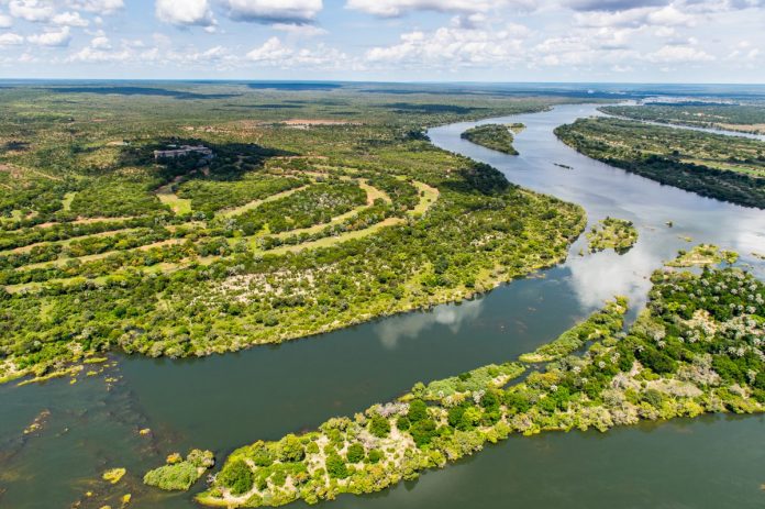
Fourth largest river in Africa, Zambezi can be termed as the best panoramic and most adventurous river in the continent that flanks six countries. If you raft the torrents of this river along with a length gauging equipment, this river will measure around 3,540 kilometers.
Natural Boundary
Commencing from the north-west region of Zambia, it flows in a double S shape to finally merge with the immense Indian Ocean. The source is located at an altitude of 5000 feet above sea level. It gushes through the eastern edges of Angola, kisses the western coast of Zambia, soaks the north-eastern margin of Namibia, and washes the minute portion of Botswana, which is an intersection of four countries of Zambia, Zimbabwe, Namibia, and Botswana.
It surges, subsequently, to form a frontier between the terrain of Zimbabwe and Zambia, and vacates the water into the Indian Ocean through several mouths. The Zambezi humidifies ten towns of Zambia after originating from the same country.
Zambezi River Source National Park
Zambezi River Source National Park embraces a botanic garden with rare species and abundant vegetation known as Zambezi River Source. It is vast expanse of more than 37 hectares.
The country of Zambia was named after the River Zambezi. Hence, a historic monument was inaugurated in the national park on 24th Oct, 1964, when Zambia became independent from the clutches of Great Britain. The copper place placed at the core of this monument reveals the date of independence, significance of Zambezi River, and Zambia’s history.
Whitewater rafting in the currents of Zambezi
The business of tourist rafting flourished after the natives started the sport in 1981 near Victoria Falls. The locals expected it to flourish at a slower pace. However, by the end of 1996, the number of people tried rafting in the Zambezi crossed the mark of 50,000. It is also noticed that the average number of people visiting Zambezi for sports is swiftly escalating each year.
Between the months of February and June, the river floods dramatically, making it impossible for tourists to raft in the rapid torrents. The volume and momentum of flood water in Zambezi is nearly four times to that of Colorado River flood. The adventure of white water rafting which starts from beneath Victoria Falls can be defined as tremendously intricate, abrupt ascents, elongated and brutal torrents, full-size plummet and force areas.
The most exciting and favorable period to endeavor rafting is amid July and January. This is the time when the water level is low, comparatively less violent, and easy. However, there are some areas like the chachment of zambia and Angola are termed as ‘high water’ in all the months and rafting there should be attempted only by professionals.
Other sports offered by this river are bungee jumping, kayaking, swimming contests, tiger fishing, and canoeing.
Wildlife
While waiting in the queue for white water rafting, check out the awesome variety of birds found near the Victoria Falls. Undersized crocodiles are also found in the water. Although they are not much harmful, a little wound can damage your tour. So, be cautious. You can spend few days in the canoe safari explore offered by the local tour providers. This safari tour will help you trek along the banks of Zambezi River through Mana Pools National Park and Lower Zambezi National Park. Witness the abundant wildlife which includes water-hippos, wild elephants, crocodiles, and vibrant birds.
The water from Kariba Dam in Zambezi River is being used by countries of Zambia and Zimbabwe for Hydropower plants. Electricity produced in South Africa also uses water from Zambezi River’s Cabora-Bassa dam. The twirling Batoka Gorge and Victoria Falls are both carved by the vigorous torrents of this river.


